Everest Base Camp Itinerary: A Measured 10-Day Day-by-Day
The table below is the measured trek — every day’s real distance, climb, elevation, hours and heart rate, recorded on a Garmin watch by Nashriq, 2–11 November 2025, with trail testimony from experienced hiker Kak Yaa, who has walked the route herself. For why the hard part isn’t the climb to Base Camp, read the companion piece on EBC trek difficulty. And if you’re choosing between the two great Base Camp treks, we put them side by side, both measured.
⚠️ This trek sleeps above 4,900 m for several nights and tops out over 5,300 m. Altitude is the real risk, not the terrain — by the Wilderness Medical Society ascent-rate guideline (above 3,000 m, raise your sleeping altitude no more than ~500 m a night) this itinerary pushes past the safe rate on a couple of nights: Dingboche (4,325 m) to Lobuche (4,925 m) is a 600 m gain, which is why many trekkers add a second acclimatisation day at Dingboche. Check it night by night in the altitude planner. This is planning information, not medical or safety advice — read the sourced altitude guide before you go.
The Measured Journey
Every metre from a measured GPS track.
Before day one: the trek starts with a flight most people underestimate
Everest Base Camp begins with the flight to Lukla (2,846 m) — one of the most weather-dependent short flights in the world. In the October–November peak, that flight often doesn’t leave from Kathmandu at all: it runs from Manthali / Ramechhap, a four-to-five-hour pre-dawn drive away, to ease congestion. Delays and cancellations are normal in either direction. Build buffer days into your trip; don’t book an international flight home the evening you’re due back in Lukla.
One expectation to set from the measured trip: the trek is front-loaded with climbing and back-loaded with descending. You gain height steadily for seven days to Base Camp, then give back nearly all of it in three big descending days. Most people train for the way up. The bill arrives on the way down — see the difficulty guide.
The two things the numbers change about how you’d plan it
The measured file points at the same two lessons, both about the second half:
- The descents are the biggest days. The three longest, most punishing days on the whole trek are all after the high point: 23.1 km down to Namche on day 9, and two more 1,000 m-plus drops either side of it. Descent-trained legs matter more here than most itineraries admit.
- Downhill at altitude costs more than downhill low down. The same walker’s heart ran about 20+ bpm higher descending from Gorakshep at 5,100 m (average 130 bpm) than on the final descent to Lukla at 2,800 m (average 107 bpm). Even for the fittest person in the group, thin air makes the “easy” downhill days real work.
23.1 km the single biggest day — and it's a descent.
−1,429 m down to Namche on day 9, after the high point, on already-tired legs.
The full measured file
Every day of the walk, measured — distance, the climb-and-descent shape on one shared scale, moving time and heart rate. Read the shape, not just the digits: the biggest days are the descents, not the climb to Base Camp.
The measured ten days
10 days · Lukla to Lukla
10 days · Lukla to Lukla
The measured days, at a glance
| Day | Route | descent m climb |
|---|---|---|
| Day 1 | Lukla Phakdingsleep 2,610 measiest day | |
| Day 2 | Phakding Namche Bazaarsleep 3,440 mbiggest climb | |
| Day 3 | Namche Namchesleep 3,440 macclimatisation | |
| Day 4 | Namche Debochesleep 3,800 m | |
| Day 5 | Deboche Dingbochesleep 4,325 m | |
| Day 6 | Dingboche Lobuchesleep 4,925 mabove the ABC summit | |
| Day 7 | Lobuche Gorakshepsleep 5,160 mBase Camp 5,282 m | |
| Day 8 | Gorakshep Pherichesleep 4,265 mKala Patthar 5,320 m | |
| Day 9 | Pheriche Namchesleep 3,490 mbiggest descent | |
| Day 10 | Namche Lukla2,850 m | |
| Total | round trip · measured |
† Heart rate is one hiker's (Nashriq, who recorded the track), November 2025 — a fit walker's floor, not a group average, so yours will likely run higher.
Swipe the trek — Day 1
Day one loses height: the trail drops from Lukla to Phakding before any of the climbing starts.
The weather-dependent flight to Lukla (2,846 m) is the real start; day one is a soft landing — 8.4 km, mostly downhill to Phakding, and the lowest average heart rate of the whole trek. Day two more than doubles it and climbs a kilometre to Namche, so treat this as a warm-up, not a measure of what’s coming.
♥ 96 bpm avg, 160 max — The trek’s lowest average, on its easiest day. One hiker (Nashriq, who recorded the track), November 2025 — a fit walker’s floor, not a group average, so yours will likely run higher.
8.4 km · +184 / −411 m · sleep 2,610 m
Kak Yaa · first-hand · Day 1The trek really starts at the airport. You fly into Lukla from Kathmandu on a small twin-engine STOL plane — a Twin Otter — and if you’ve never been on one, it can be a genuinely scary flight. Tenzing-Hillary is ranked among the most dangerous airports in the world: high winds, fog that rolls in without warning, and a runway that ends in a sheer drop. Once you’re down and walking to Phakding, though, it’s gentle — quite flat, mostly downhill, an easy first afternoon.
About three-quarters of Kinabalu’s Timpohon → Laban Rata climb (1,406 m) — and the biggest climb on the whole trek.
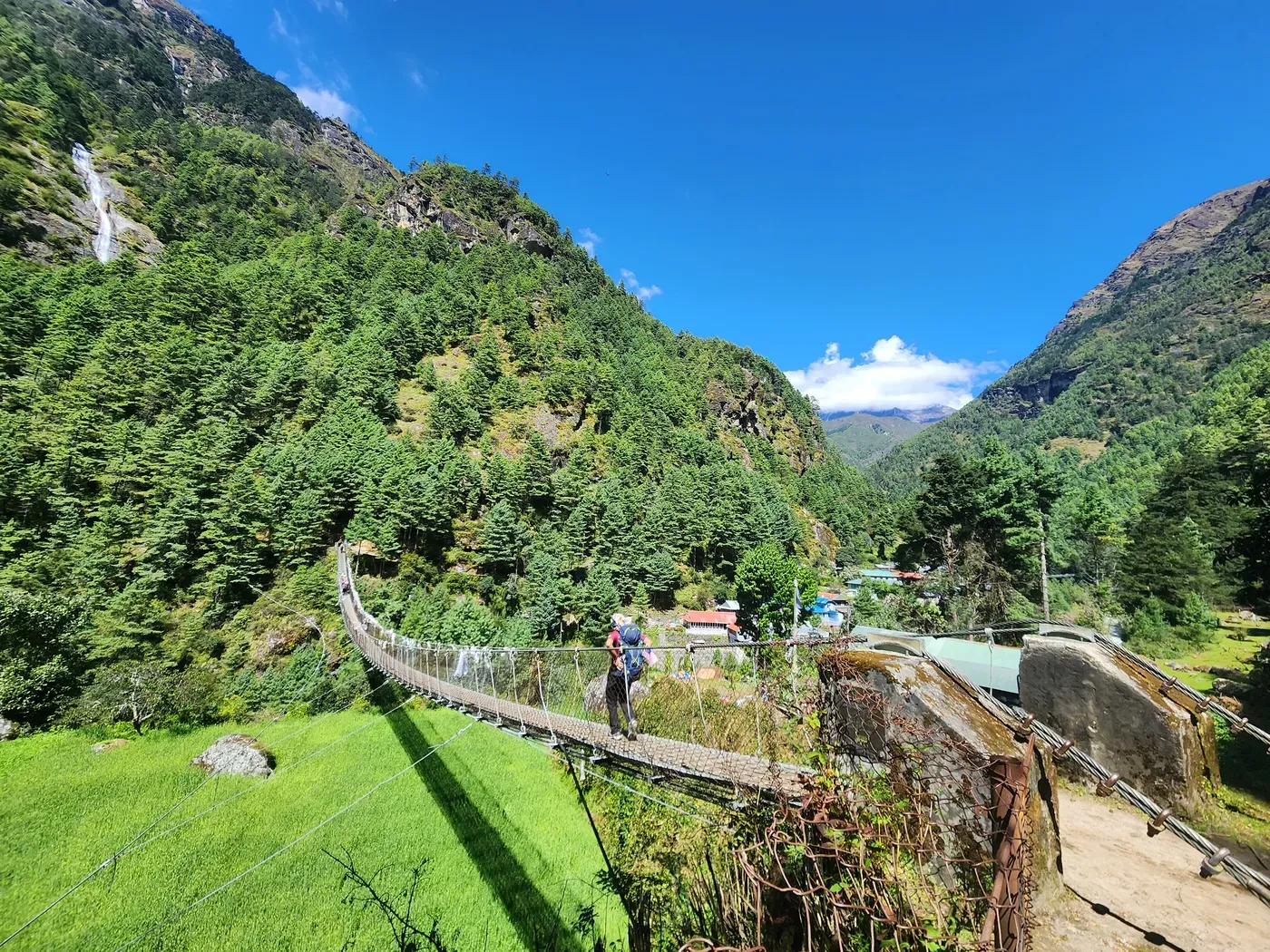
From Phakding the trail crosses the Dudh Koshi on high suspension bridges, then climbs steeply to Namche Bazaar (3,440 m), the Sherpa hub. It is the biggest climbing day on the trek — 1,017 m — and it lands early, before you are acclimatised. Go slow; this is where an over-eager first two days catches people out.
♥ 116 bpm avg, 174 max — Its peak came on the steep climb to Namche. One hiker (Nashriq, who recorded the track), November 2025 — a fit walker’s floor, not a group average, so yours will likely run higher.
16.1 km · +1,017 / −244 m · sleep 3,440 mYou end where you started, at Namche. The point is the climb up toward Hotel Everest View and back — not distance.
The standard rest day, and it is not rest: a loop up toward Hotel Everest View (≈ 3,880 m) and back down to sleep at Namche. Climb high, sleep low — the acclimatisation the whole schedule is built around. Skip it and you carry more altitude risk into the nights above 4,900 m to come.
♥ 105 bpm avg, 174 max — Recorded across the climb-high-sleep-low loop. One hiker (Nashriq, who recorded the track), November 2025 — a fit walker’s floor, not a group average, so yours will likely run higher.
11.6 km · +534 / −553 m · sleep 3,440 mA big up-and-down day: you drop to the river, climb to Tengboche monastery, then drop again into the forest at Deboche.
The classic Khumbu day — down to the Dudh Koshi, a steep climb to Tengboche monastery, then down into the fir forest at Deboche (3,800 m). 920 m of climbing over 16.4 km, the monastery pitch the hardest stretch, with the first clear views of Ama Dablam ahead.
♥ 119 bpm avg, 158 max — A steady day’s effort, no single crux. One hiker (Nashriq, who recorded the track), November 2025 — a fit walker’s floor, not a group average, so yours will likely run higher.
16.4 km · +920 / −559 m · sleep 3,800 mYou cross above the treeline into the open upper valley; Dingboche is a common second acclimatisation base.
Above Deboche the forest gives way to the open, arid upper valley. A steadier day — 651 m up, little down — to Dingboche (4,325 m). Many itineraries add a second acclimatisation day here before pushing above 4,900 m. From now on the altitude is the thing to manage, not the gradient.
♥ 114 bpm avg — Steady work as the air thins. One hiker (Nashriq, who recorded the track), November 2025 — a fit walker’s floor, not a group average, so yours will likely run higher.
13.8 km · +651 / −120 m · sleep 4,325 mHigher than the top of the entire Annapurna Base Camp trek (4,136 m) — and this is only where you sleep, not the day’s high point.
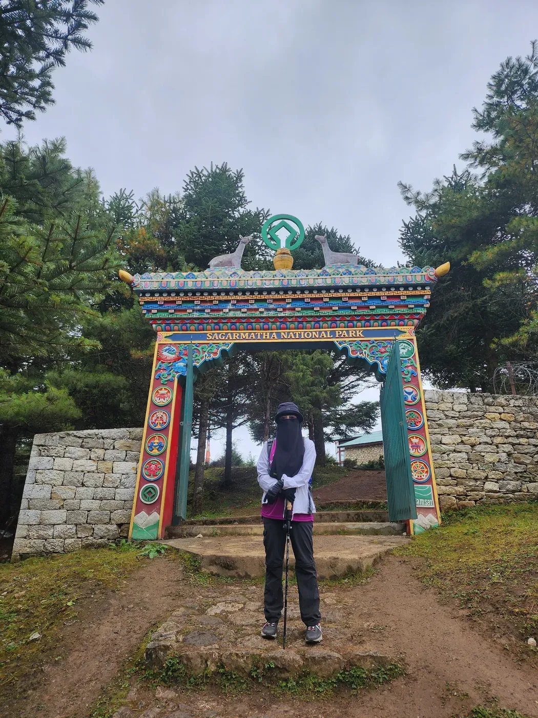
Up the Khumbu valley, past the memorials at Thukla, to Lobuche (4,925 m). Only 658 m of climbing, but you now sleep higher than the highest point of the entire ABC trek — and the cost of altitude shows: the highest average heart rate since the Namche climb, for a day that is modest on paper.
♥ 125 bpm avg, 153 max — The cost of altitude on a modest climb. One hiker (Nashriq, who recorded the track), November 2025 — a fit walker’s floor, not a group average, so yours will likely run higher.
12.7 km · +658 / −61 m · sleep 4,925 mThe measured high point at Base Camp. Above 5,000 m, distance and thin air do the work gradient does lower down.
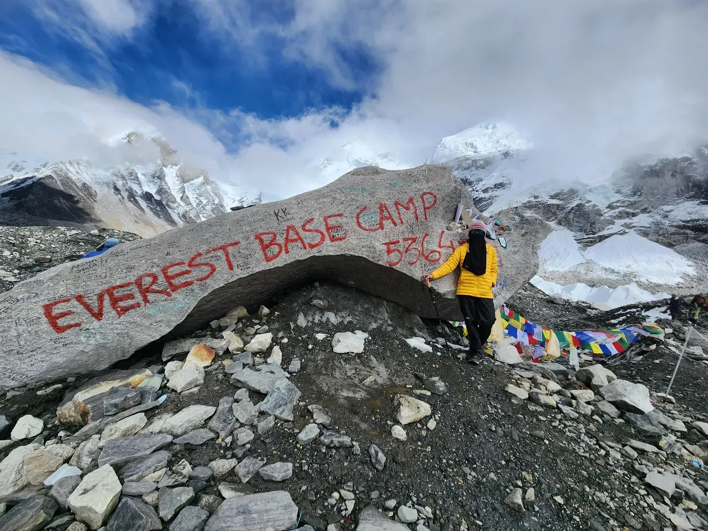
Lobuche to Gorakshep, drop the pack, then out along the glacier to Everest Base Camp (measured 5,282 m) and back. Only 551 m of net climbing, but it was the longest day out of the trek — about 11.4 hours door to door — because above 5,000 m everything is slow. The reward is standing at the foot of the Khumbu Icefall.
♥ 109 bpm avg, 167 max — A long, slow, high day out to Base Camp. One hiker (Nashriq, who recorded the track), November 2025 — a fit walker’s floor, not a group average, so yours will likely run higher.
15.8 km · +551 / −318 m · sleep 5,160 mThe pre-dawn viewpoint — the 5,320 m shoulder, not the 5,545 m summit — the highest you stand on the trek, before the descents begin.
A pre-dawn climb to the Kala Patthar shoulder (5,320 m) for the classic view back at Everest, then the long descent to Pheriche — the first of the three big drops that make the second half the hard part. The trek’s highest average heart rate, on its coldest, thinnest morning.
♥ 133 bpm avg, 176 max — The trek’s highest, on the pre-dawn Kala Patthar push. One hiker (Nashriq, who recorded the track), November 2025 — a fit walker’s floor, not a group average, so yours will likely run higher.
18.1 km · +292 / −1,190 m · sleep 4,265 mThe single biggest descent of the trek, over 23.1 km — the longest day on your feet, almost all of it downhill on tired legs.
Pheriche back down to Namche — the longest and biggest-descending day of the whole trek, 23.1 km and 1,429 m down. Downhill at altitude is not free: on this trek the same walker’s heart ran about 20 bpm higher descending from up high than on the final drop to Lukla. This is the day the descents-are-the-hard-part finding is built on.
♥ 105 bpm avg, 151 max — HR under-reads a descent — the cost here is muscular, not cardiovascular. One hiker (Nashriq, who recorded the track), November 2025 — a fit walker’s floor, not a group average, so yours will likely run higher.
23.1 km · +665 / −1,429 m · sleep 3,490 mThe last day still climbs: the trail back to Lukla is broken by real uphill on the tiredest legs of the trek.
Namche back to Lukla (2,850 m) to close the loop — 21.8 km, and despite being the way out it still climbs 672 m over the rolling trail before the final drop to the airstrip. Then the weather-dependent flight back to Kathmandu: build buffer days, and don’t book an international flight for the evening you are due to land in Lukla.
♥ 107 bpm avg, 147 max — The rolling final day back to Lukla. One hiker (Nashriq, who recorded the track), November 2025 — a fit walker’s floor, not a group average, so yours will likely run higher.
21.8 km · +672 / −1,101 m · finishTimes are past tense from real GPS moving time — we measured them, we didn't estimate them. Elevation gain is the device's barometric figure. Heart rate is one hiker's, shown only as corroboration.
Day 8 pairs the pre-dawn walk to the Kala Patthar shoulder (5,320 m — not the 5,545 m summit) with the long descent to Pheriche. The biggest single day is the descent out: day 9’s 23.1 km, −1,429 m drop to Namche — longer and steeper down than any climb on the way up. That’s the trek’s real bill, and it lands when your legs are already ten days tired.
How to read your own days off this
- Day 1 is the easiest day of the trek — short, mostly downhill to Phakding. Don’t let it set your expectations; day 2 more than doubles it and climbs a kilometre to Namche.
- The middle days are steady, not brutal — five to six moving hours, 600–1,000 m of climbing, at a deliberately slow altitude pace. The load is the altitude and the accumulation, not any single savage climb.
- The high day is long, not steep — day 7 to Base Camp and back to Gorakshep was 11.4 hours door to door for only 551 m of net climbing. Above 5,000 m, distance and thin air do the work that gradient does lower down. We logged roughly 14.5 hours in total above 5,000 m across the top of the trek.
- The last three days are the descents — this is where knees and quads get the bill. Train for the way down; see the Trek-Ready Program for the descent-specific work.
The whole route is now on the interactive map — every metre of Nashriq’s GPS track, with the checkpoints, elevation and heart rate you can scrub along. The numbers above are the measured trek, honest about being one strong walker’s record.
Frequently asked
How many days is the Everest Base Camp itinerary?
What is the day-by-day for the Everest Base Camp trek?
Which is the hardest day of the Everest Base Camp trek?
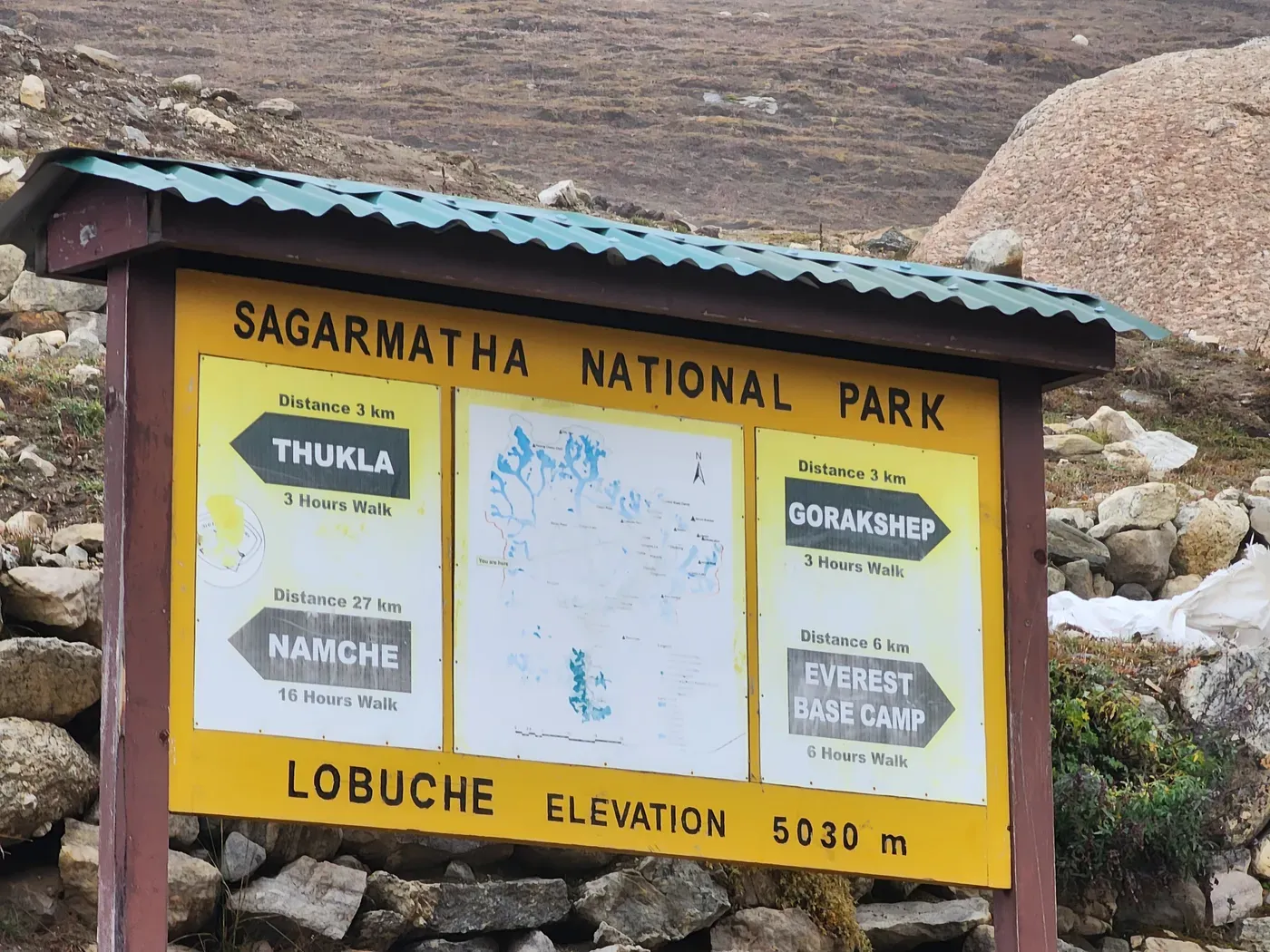
How high is Everest Base Camp, and is Kala Patthar higher?
How many hours a day do you walk on the Everest Base Camp trek?
What is the easiest day on the Everest Base Camp trek?
Do you need acclimatisation days on the Everest Base Camp trek?
Which airport do you fly into for Everest Base Camp?
Discussion
Loading discussion…